Published
- 2 min read
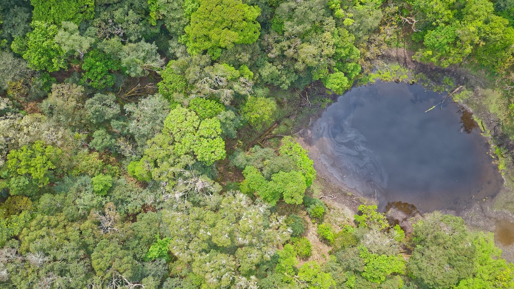
舞樂鬼湖正射影像

線上瀏覽
全螢幕檢視❐位於關山9林班稜線上的小湖,取像時湖面呈橢圓型狀,面積約為1447 Sq Meters。
「舞樂鬼湖」一詞參考自台大山社1、台灣山岳2與OpenStreetMap的編輯紀錄3。惟此區域鄰近Bulaksang舊社4,在尚未確認其傳統知識體系中對此湖的稱呼前,暫以舞樂鬼湖與bulaksang-pond稱之。
拍攝參數
| 參數 | 值 |
|---|---|
| Ground sampling distance | 2.7 cm/px |
| Mission type | Grid |
| Alitude | 100 m |
| Overlap | 90% along and across track |
| Platform | UAV |
| Sensor | FC3682 |
| Date start | 2024-04-20 14:00 |
| Date end | 2024-04-20 15:00 |
| CE90 | Absolute: 1.622m, Relative: 0.293m |
| LE90 | Absolute: 1.598m, Relative: 0.786m |
圖資介接
正射影像圖資託管於OpenAerialMap 平台,可透過XYZ Layer(TMS)或WMTS服務介接,授權方式為CC BY-NC 4.0。
| 格式 | URL |
|---|---|
| TMS | https://tiles.openaerialmap.org/66276f0d5ffd0b000134b997/0/66276f0d5ffd0b000134b998/{z}/{x}/{y} |
| WMTS | https://tiles.openaerialmap.org/66276f0d5ffd0b000134b997/0/66276f0d5ffd0b000134b998/wmts |
Footnotes
-
崙天探雙魚眼瀑布訪舞樂鬼湖 ↩
-
140╱漂鳥之心 從雲端發現的舞樂鬼湖 ↩
-
路徑歷史:舞樂鬼湖 (407413189) https://www.openstreetmap.org/way/407413189/history/6 ↩
-
強制移住──臺灣高山原住民的分與離 高山原社位置圖(1931-1945) ↩